New ZEALAND 2001 (PART 6)


Okay, why don't I like backpacker hotels? It's not just the bring your own sheets/towels and that you may or may not get a private room. I guess I'm just a bit too old to be sleeping in the same room with a bunch of 18 year olds who are determined to get drunk and throw up every night. But I digress.
So it's another early wake up. The Routeburn Track (one of NZ's Great Walks) starts near Te Anua (actually near Milford Sound) and then ends up near Queenstown. I sleep on the bus while we head back to TeAnua where we stop for tea at a hotel. This hotel is the coordination center for the Milford Track, another of the Great Walks in NZ. There is a limit on the number of people who can be on the track and there is a waiting list with openings starting in late March!! But apparently this track is absolutely amazing. Maybe next time. I do stay awake this time on the road up to Divide (which is right before Milford Sound) and I must say that the scenery is quite spectacular. It starts off with this dry grassy rolling hills and then you start to approach the foothills. The road goes through three different ecological zones: the grassy rolling hills, then a temperate rain forest in the valley, to a high alpine grass and scrub bushes as it reaches the summit. We stop at Divide and of course, the sand flies are out. But I'm a veteran and don't panic. A little Jungle Juice and Iam good to go. We pick up our bag lunches and then head up the mountain. The weather is just delightful. Partly cloudy, some lingering low clouds that seem to drape themselves over the rugged mountain tops. And I'm hiking up. The trail is well formed and it's not too steep. I start off in the middle of the pack talking with one of the married women about hiking, etc. It's quite pleasant and not too strenuous. This is the only stretch of the track that passes through a lower altitude silver beech forest and it is just beautiful. Now I mentioned before about how they filmed the Lord of the Rings Trilogy here. And I can tell you why. There is no other place in the world that makes me think of The Middle Earth like the natural beauty of the forest and mountains of NZ. I can't wait to see the film. After about 45 minutes, we reach a turn off for an optional hike up to Key Summit. Sure, I'm game. So I drop my backpack and head up the side of the mountain. The trail is a bit steeper and zig zags it's way up. We leave the silver beeches right away and are not in the upper alpine area of grassy tussocks and small scrub bushes. But the climb to the summit is definitely worth it. They claim that the hiking to the summit is like attending a meeting of the mountains. From here you can you have the most spectacular views of the nearby mountain ranges, many with snow still on them even this late in summer, as well as three valleys which take water to three different coats: The Greenstone river to the east coast, the Eglington to the south coast, and the Hollyford which drains to the west coast. There is a little alpine lake and some bogs here and I take the time to do the nature walk. There are still some flowers blooming here and you really feel like you are on top of the world. After I short break to just sit back and relax, then it's back down the mountain. I am pretty much alone on the trail and it is nice to be in my own head for a while and just soak up the glorious views. I head down now moving through more forest of moss-covered beeches. Every once in awhile there will be a break in the trees and I can catch glimpses of the majestic snow covered mountaintops in the distance. Just sooooo cool. We stop for lunch at one of the DOC (Dept of Conservation) huts near Lake Howden. After leaving Lake Howden, the trail goes back up, but it is not too bad. A bit rockier, but I can deal. The trail goes steadily up for about 90 minutes till we get to the Earland Falls. It hasn't really rained here in the past four days, but the amount of water coming over the top is just amazing, and then it falls 80 meters into this rock filled pool before draining further down the mountain. I am more than happy to sit on a nice sized granite boulder in the middle of the pool, dip my feet in the crystal clear mountain water, and bask in the sun. The water's cold, but it feels good as the sun has really come out and I am definitely sweating. One of the guides swims in the water, but I decide to wait for the lake near our lodge for the evening so I won't have to walk in wet shorts. We finally gear up and head out along the trail again. It's mostly level for about 30 minutes as I pass between alternate areas of silver beech forests and sub alpine scrub. There are places where winter avalanches have wiped away the vegetation and you can get the most amazing views of the Darren Mountains, the highest peaks in the Fiordlands National Park, across the Hollyford Valley. Then I enter the orchard, a strange but pretty place where ribbonwood trees grow that look like apple trees. They grow in almost straight lines like they were planted. Very unusual. After the orchard, it's about a 20-minute ascent on the trail and then a 30-minute descent to the Lake Mackenzie Lodge. There are parts of the trail that are steep and that's not something I really like. The "lodge" is nice, but not a ski lodge type of place. There are bunkrooms, bathrooms, and a lounge/dining room/kitchen area. There is a small pool next to Lake Mackenzie that is about 5 degrees warmer than the lake so that's what I'm looking forward to. Only, the sun is gone now. The afternoon clouds have rolled in and it's not really that warm now. Ozz (one of the guys on the trip) dips his foot in the water and declares that it is too cold. But does that stop me? Oh no. Not only do I go in, but I run and then dive into to the pool. Wow, that's more that a little brisk. I swim about in the water for 2.3 minutes and then decide a hot shower sounds really good. So it's back to the lodge for a nice long hot shower. I like this style of camping.
The next day we start off again early. Weather? Rain. It started off raining pretty hard when we got up, but by the time we started hiking, it had turned to alternating mist and drizzle. Now you know that we have Murphy's Law, right? The British call it the Law of Sod. Now I'm really not sure what Sod is, except that sod off is basically equivalent to . . . oh never mind. So why do I bring this up. My camera battery has died. And I didn't bring a spare. Bad Trey, bad Trey. But I got over it (okay, I really never got over I just decided not to bitch about it). I did ask the Japanese if they had a spare (I mean, you should see the photographic gear they had) but they didn't have the right type. But the weather sucked and I wouldn't want pictures like this anyways (see, more rationalization). After we circled Lake Mackenzie, we entered the silver beech forest as we begin our climb up. Now in the light mist and shadowy grey light, I can definitely imagine a band of elves walking along. It really was quite magical. Once under cover of the trees, I get hot so the raincoat comes off. We continue to hike up and then we leave the beech forest. Ozz and I are walking together today and I think this is a good thing. Walking over the dirt and rocks on a dry day wasn't too bad. But now there are more rocks that dirt and most have some sort of moss or lichen on them. Wet moss or lichen on them. Slippery? Oh yeah. The zigzag track takes us up the side of the mountain above the forest and back into that sub alpine zone of grassy tussocks and scrub bushes. After about 90 minutes we reach Ocean Peak Corner where on a clear day you can see Martin's Bay where the Hollyford River meets the Tasman Sea. Oh never mind. The weather is tolerable and actually a bit cool. The grey light makes the low clouds look pretty magical and every once in a while the wind picks up and swirls a low hanging cloud past us, momentarily wrapping us in a blanket of white, and then it's gone. The alternating mist plus the wind means the rain jacket is back on, but I am quite comfortable, except for all the hiking and climbing up over rocks. We continue on and the track swings around to begin an undulating traverse of the Hollyford face. We can't see the anything to the left of us; below us, we
can see a little bit of steep grassy hill before it disappears into the low fog, and above us, we can only see the outline of the jagged mountain tops with little glimpses of snow. It really is quite pretty. Now this is the most exposed portion of the track so of course
the wind picks up. It is quite fierce and we are crouching along as we hike to limit our exposure to the wind. Despite the bad weather, there are still flowers in bloom here: Mount Cook lillies (which are world's largest buttercups) and large mountain daisies. But we aren't stopping to smell the roses. We keep moving on and reach our lunch spot about 1130, the Harris Saddle shelter (elev. 1277m). There is an "optional" walk up Conical Hill (1515m) where the view is supposed to be remarkable. Hello, we can't see 500 yards in this weather, so why climb 200+ meters for nothing. Now this trip is a guided walk. I did this because I'm definitely not comfortable doing this by myself, plus the logistics would suck: carry my own tent, sleeping bag, food, etc. But there are a number of independent walkers out. Mainly kiwis, but a few German and Israelis. It's very interesting to see who is doing this. A lot of women are on the track which I find interesting. At the Harris Saddle, the track enters Mt. Aspiring National Park and climbs to its highest point (1310m) on the bluffs above Lake Harris. At this point in the trip, I am definitely amusing Ozz as every time we hit one of these steep, slipper, all rock sections, I am muttering some choice words (hey sailors know how to cuss). And there are quite a few of them. I am bound and determined not to fall and kill myself. I slip a couple of times, but no damage. Then it's all downhill to the lodge. Doesn't that sound easy? Well it's not. While going up steep slipper rocks is not fun, going down them is worse. We drop in to a high alpine valley where the mountains seem almost a stone's through away. The mist continues, but the visibility has improved and the snow patches on the rocky crags of the mountains on either side of the valley are quite picturesque. There is a small lake that bleeds off a small stream that slowly grows and becomes the Routeburn River. It takes about 90 minutes to work our way down the valley and to the Routeburn Falls Lodge where a cold beer awaits (another advantage of the guided walk option). The lodge has a resident Kea, which is an alpine parrot. It is quite pretty and not shy and will pinch your stuff if you are not careful.


After another restful night sleep (read with HEAVY sarcasm), it's up for the last day of the hike. The weather is still iffy outside. Overcast and grey, with a bit of misting. Bad for photos anyways. The track from the Routeburn Falls Lodge down the mountain is steep again, and rocky, and Ozz has nicknamed me "Rocky". Funny. Not. For about an hour the track drops through a mix of silver, mountain, and red beeches, all covered in moss, as well as all kinds of ferns. There is one part of the trail where an avalanche has occurred about 2 years ago and the earth is just torn apart, the devastation just amazing, and the only thing growing is the grass. As we hit the bottom of the valley, we stop at the Routeburn Flats Hut for a quick tea break. Then we continue on along the flats as the river enters the valley. The path is level and it has stopped misting so it is quite nice. The forest is just stunning. The moss covered beech trees just magical and it is so quiet. We cross a couple of wire swinging bridges. Lots of fun. There are a couple that are 1 person load only. Love it! The valley narrows and the river enters a gorge. We hike along the side of the gorge going up and down as we follow the river. The gorge opens up for a bit and we stop at a place called Forge Flat. Among the beeches, the river rages as the crystal clear water rushes between some big boulders forming a little pool where dead tree trunks litter the sides. On a fine day, it's good for a swim. But one of our guides decides to go for it and jumps from one of the rocks into the water, the current carries him a bit and then he climbs out. I'm hooked. I change into my swimsuit and cross the little stream to get to the boulder. The water's cold, but not that bad. I stand on top of the rock for a moment, must my courage (or stupidity) and jump in. I go deep. And it's cold. It's like paralyzing cold. I freak for a second and then kick my way to the surface. The current has carried my a bit farther than Jamie and I surface right next to a log. So I duck that and then quickly swim to the edge of the pool and climb out. Wow. It was awesome, but not something I'd do again. I had time to dry off and change before the rest of the group showed up. We had lunch there and had time to relax since the bus was not going to be at the trailhead till 2PM. The rest of the hike along the side of the gorge was just as pretty as the whole track. The weather was clearing, the sun was coming out, and it was just so amazingly pretty as we crossed the last wire swinging bridge over the Routeburn River to the tracks end. The bus showed up and we were off to a local bar in Glenorchy for a celebratory beer and group picture. We were back in Queenstown around 4PM and I was back at my "hotel". I am now hooked on these Great Walks. There are about 6 or 7 of them in NZ and I want to do another. I think it's one of the best ways to really experience NZ. Guided would be good, though I think an independent walk could be better.
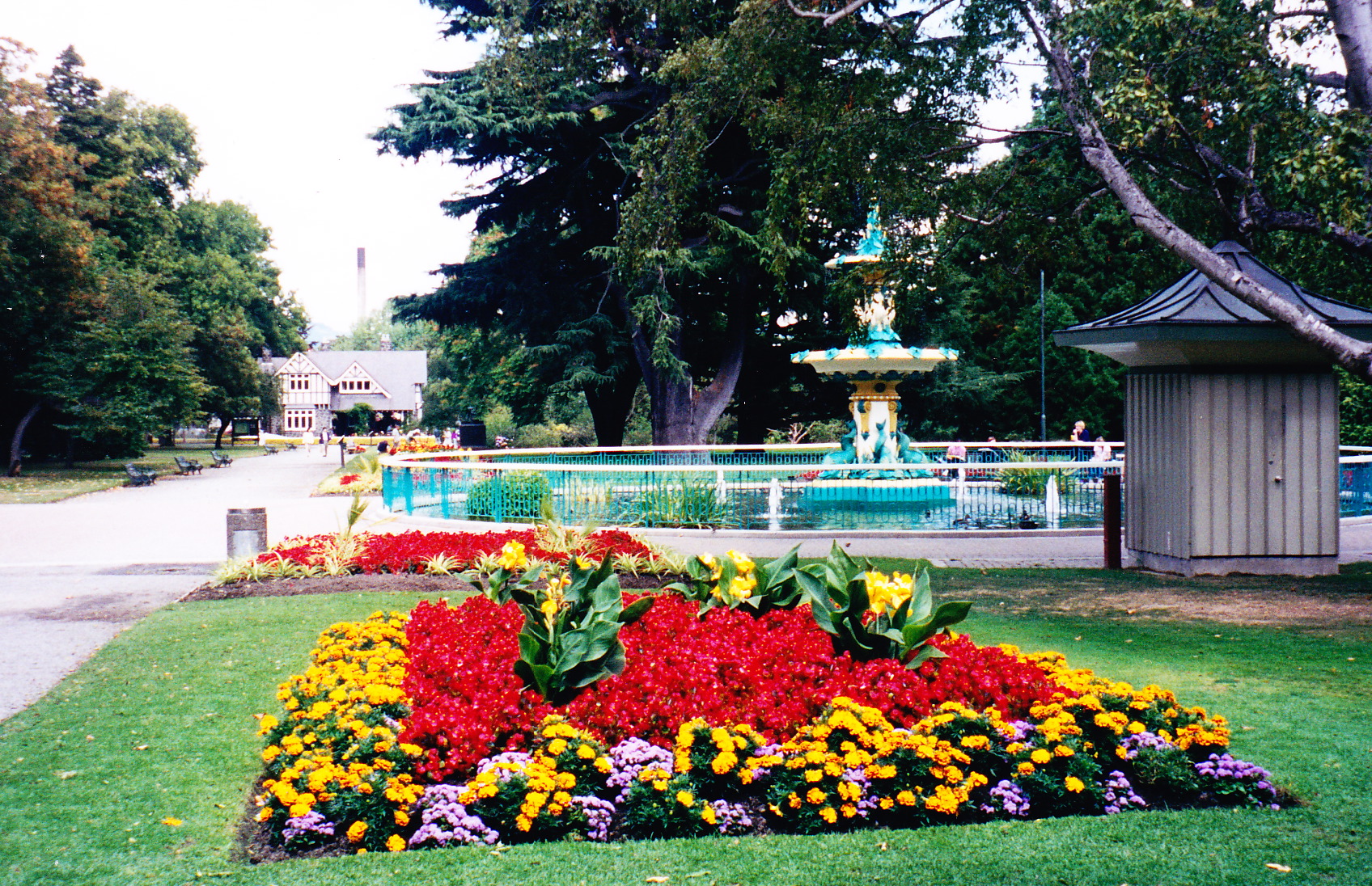
I got up early the next day (I think it's programmed now) and hit the road. The drive from Queenstown to Christchurch was about 6 hours. The first part was pretty nice, rolling hills, grass lands, though it was a bit overcast. But then as I hit the Canterbury Plains, I sort of wanted to yawn. Have you seen Kansas? Large farms with cattle everywhere. Okay now add sheep. The one odd thing I did note was that they had these HUGE hedges. It looks like they got a bunch of trees to grow really close to each other and then took a big branch cutter and made them perfectly smooth. But huge. I think the tops were over 30 ft high. What's with that? Wind breaks? Don't know. Christchurch is supposed to be the most English city outside of England. So I got there and it was overcast, grey, and a bit cold. Sounds like England. I relaxed a bit before having dinner at the hotel and then walking around Christchurch a bit. The next day, I got up and went for a run. Even after all the hiking, the run still sucked. Go figure. I wandered around Christchurch taking in the Arts Center, the museum, an art gallery, and the botanical gardens. The annual flower festival had ended the previous day, but the flowers were amazing. So many types and colors. I had lunch at a small cafe next to the Avon while some folks went for punt rides. It looked cool, but I wasn't interested. I called it an early night since I had a 7AM flight the next day to Oz.